Weather Alert in Illinois
Flood Warning issued March 5 at 11:16AM CST until March 14 at 1:00AM CDT by NWS Paducah KY
AREAS AFFECTED: Gallatin, IL; Hardin, IL; Crittenden, KY; Union, KY
DESCRIPTION: ...The National Weather Service in Paducah KY has issued a Flood Warning for the following rivers in Illinois...Kentucky... Ohio River at Shawneetown affecting Gallatin, Union, Crittenden and Hardin Counties. .Minor flooding is expected on the ohio river due to heavy rainfall over the area. It will remain above flood stage until March 13th currently forecasted. For the Ohio River...including Owensboro, Newburgh Dam, Evansville, Henderson, Mount Vernon, J.T. Myers Dam, Shawneetown, Golconda, Smithland Dam, Paducah, Olmsted Lock and Dam, Cairo...Minor flooding is forecast. * WHAT...Minor flooding is forecast. * WHERE...Ohio River at Shawneetown. * WHEN...From Tuesday morning to Saturday, March 14. * IMPACTS...At 33.0 feet, Minor flooding occurs affecting mainly bottomland and surrounding low lying areas. * ADDITIONAL DETAILS... - At 10:30 AM CST Thursday the stage was 19.9 feet. - Forecast...The river is expected to rise above flood stage Tuesday morning to a crest of 33.3 feet Thursday, March 12. It will then fall below flood stage Friday, March 13. - Flood stage is 33.0 feet.
INSTRUCTION: Turn around, don't drown when encountering flooded roads. Most flood deaths occur in vehicles. Caution is urged when walking near riverbanks.
Want more detail? Get the Complete 7 Day and Night Detailed Forecast!
Current U.S. National Radar--Current
The Current National Weather Radar is shown below with a UTC Time (subtract 5 hours from UTC to get Eastern Time).

National Weather Forecast--Current
The Current National Weather Forecast and National Weather Map are shown below.

National Weather Forecast for Tomorrow
Tomorrow National Weather Forecast and Tomorrow National Weather Map are show below.

North America Water Vapor (Moisture)
This map shows recent moisture content over North America. Bright and colored areas show high moisture (ie, clouds); brown indicates very little moisture present; black indicates no moisture.

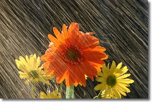
Weather Topic: What is Precipitation?
Home - Education - Precipitation - Precipitation
 Next Topic: Rain
Precipitation can refer to many different forms of water that
may fall from clouds. Precipitation occurs after a cloud has become saturated to
the point where its water particles are more dense than the air below the cloud.
In most cases, precipitation will reach the ground, but it is not uncommon for
precipitation to evaporate before it reaches the earth's surface.
When precipitation evaporates before it contacts the ground it is called Virga.
Graupel, hail, sleet, rain, drizzle, and snow are forms of precipitation, but fog
and mist are not considered precipitation because the water vapor which
constitutes them isn't dense enough to fall to the ground.
Next Topic: Rain
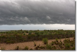
Weather Topic: What are Shelf Clouds?
Home - Education - Cloud Types - Shelf Clouds
 Next Topic: Sleet
A shelf cloud is similar to a wall cloud, but forms at the front
of a storm cloud, instead of at the rear, where wall clouds form.
A shelf cloud is caused by a series of events set into motion by the advancing
storm; first, cool air settles along the ground where precipitation has just fallen.
As the cool air is brought in, the warmer air is displaced, and rises above it,
because it is less dense. When the warmer air reaches the bottom of the storm cloud,
it begins to cool again, and the resulting condensation is a visible shelf cloud.
Next Topic: Sleet
Current conditions powered by WeatherAPI.com


