Weather Alert in Indiana
Special Weather Statement issued February 6 at 2:58PM EST by NWS Louisville KY
AREAS AFFECTED: Orange; Washington; Scott; Jefferson; Dubois; Crawford; Perry; Harrison; Floyd; Clark; Hancock; Breckinridge; Meade; Ohio; Grayson; Hardin; Bullitt; Jefferson; Oldham; Trimble; Henry; Shelby; Franklin; Scott; Harrison; Spencer; Anderson; Woodford; Fayette; Bourbon; Nicholas; Nelson; Washington; Mercer; Jessamine; Clark; Larue; Marion; Boyle; Garrard; Madison; Butler; Edmonson; Hart; Green; Taylor; Casey; Lincoln; Logan; Warren; Simpson; Allen; Barren; Monroe; Metcalfe; Adair; Russell; Cumberland; Clinton
DESCRIPTION: Another Arctic cold front will drop into the region from the north tonight. Just ahead of the front, a band of snow showers and a few snow squalls are expected to drop southward through the region. The most favored time for this activity will be between 900 PM and 4 AM EST. Much of the snow shower activity will move across central and eastern Kentucky, mainly east of the I-65 corridor. Any accumulations look to be minimal and likely under a half of an inch. However, this snow falling at night and temperatures dropping into the 20s may result in areas of slick travel tonight along with reduced visibility within the snow showers. If you have travel plans for late tonight or early Saturday, you should exercise caution and allow extra time to reach your destination.
INSTRUCTION: N/A
Want more detail? Get the Complete 7 Day and Night Detailed Forecast!
Current U.S. National Radar--Current
The Current National Weather Radar is shown below with a UTC Time (subtract 5 hours from UTC to get Eastern Time).

National Weather Forecast--Current
The Current National Weather Forecast and National Weather Map are shown below.

National Weather Forecast for Tomorrow
Tomorrow National Weather Forecast and Tomorrow National Weather Map are show below.

North America Water Vapor (Moisture)
This map shows recent moisture content over North America. Bright and colored areas show high moisture (ie, clouds); brown indicates very little moisture present; black indicates no moisture.

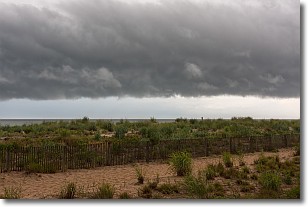
Weather Topic: What are Shelf Clouds?
Home - Education - Cloud Types - Shelf Clouds
 Next Topic: Sleet
A shelf cloud is similar to a wall cloud, but forms at the front
of a storm cloud, instead of at the rear, where wall clouds form.
A shelf cloud is caused by a series of events set into motion by the advancing
storm; first, cool air settles along the ground where precipitation has just fallen.
As the cool air is brought in, the warmer air is displaced, and rises above it,
because it is less dense. When the warmer air reaches the bottom of the storm cloud,
it begins to cool again, and the resulting condensation is a visible shelf cloud.
Next Topic: Sleet
Weather Topic: What is Snow?
Home - Education - Precipitation - Snow
 Next Topic: Stratocumulus Clouds
Snow is precipitation taking the form of ice crystals. Each ice crystal, or snowflake,
has unique characteristics, but all of them grow in a hexagonal structure.
Snowfall can last for sustained periods of time and result in significant buildup
of snow on the ground.
On the earth's surface, snow starts out light and powdery, but as it begins to melt
it tends to become more granular, producing small bits of ice which have the consistency of
sand. After several cycles of melting and freezing, snow can become very dense
and ice-like, commonly known as snow pack.
Next Topic: Stratocumulus Clouds
Current conditions powered by WeatherAPI.com


