Weather Alert in California
Winter Storm Watch issued February 13 at 11:06AM PST until February 18 at 10:00PM PST by NWS Reno NV
AREAS AFFECTED: Greater Lake Tahoe Area; Greater Lake Tahoe Area
DESCRIPTION: * WHAT...Heavy snow. Snow accumulations between 18 to 30 inches in the Tahoe Basin, highest on the west shore, and much of Alpine County. This includes Tahoe City, Homewood, South Lake Tahoe, Carnelian Bay, Hope Valley, and Markleeville. Sierra snow accumulation of 2 to 5 feet. Winds gusting 35 to 45 mph in valleys, with Sierra ridge gusts over 100 mph. * WHERE...Greater Lake Tahoe Area. * WHEN...From Sunday evening through Wednesday evening. * IMPACTS...Travel could be very difficult to impossible with periods of white out conditions. Very strong winds could cause damage to trees and power lines. * ADDITIONAL DETAILS...The highest snowfall rates will be late Monday afternoon through Tuesday afternoon.
INSTRUCTION: Monitor the latest forecasts for updates on this situation. Persons should consider delaying all travel. Motorists should use extreme caution if travel is absolutely necessary.
Want more detail? Get the Complete 7 Day and Night Detailed Forecast!
Current U.S. National Radar--Current
The Current National Weather Radar is shown below with a UTC Time (subtract 5 hours from UTC to get Eastern Time).

National Weather Forecast--Current
The Current National Weather Forecast and National Weather Map are shown below.

National Weather Forecast for Tomorrow
Tomorrow National Weather Forecast and Tomorrow National Weather Map are show below.

North America Water Vapor (Moisture)
This map shows recent moisture content over North America. Bright and colored areas show high moisture (ie, clouds); brown indicates very little moisture present; black indicates no moisture.

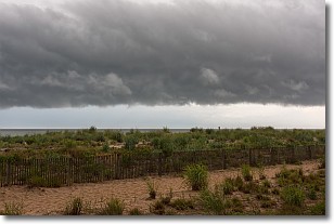
Weather Topic: What are Shelf Clouds?
Home - Education - Cloud Types - Shelf Clouds
 Next Topic: Sleet
A shelf cloud is similar to a wall cloud, but forms at the front
of a storm cloud, instead of at the rear, where wall clouds form.
A shelf cloud is caused by a series of events set into motion by the advancing
storm; first, cool air settles along the ground where precipitation has just fallen.
As the cool air is brought in, the warmer air is displaced, and rises above it,
because it is less dense. When the warmer air reaches the bottom of the storm cloud,
it begins to cool again, and the resulting condensation is a visible shelf cloud.
Next Topic: Sleet
Weather Topic: What is Snow?
Home - Education - Precipitation - Snow
 Next Topic: Stratocumulus Clouds
Snow is precipitation taking the form of ice crystals. Each ice crystal, or snowflake,
has unique characteristics, but all of them grow in a hexagonal structure.
Snowfall can last for sustained periods of time and result in significant buildup
of snow on the ground.
On the earth's surface, snow starts out light and powdery, but as it begins to melt
it tends to become more granular, producing small bits of ice which have the consistency of
sand. After several cycles of melting and freezing, snow can become very dense
and ice-like, commonly known as snow pack.
Next Topic: Stratocumulus Clouds
Current conditions powered by WeatherAPI.com


