Weather Alert in California
Fire Weather Watch issued July 29 at 12:10AM PDT until July 30 at 11:00PM PDT by NWS Eureka CA
AREAS AFFECTED: Lower Middle Klamath; Trinity
DESCRIPTION: ...ISOLATED TO SCATTERED DRY THUNDERSTORMS POSSIBLE WEDNESDAY AROUND KLAMATH MOUNTAINS... ..Isolated to scattered dry thunderstorms are possible Wednesday afternoon/evening with the highest confidence in NE Trinity County.. The National Weather Service in Eureka has issued a Fire Weather Watch, which is in effect from Wednesday morning through Wednesday evening. * AFFECTED AREA...Fire weather zone 204. Fire weather zone 283. * THUNDERSTORMS...Dry Thunderstorms with associated lightning are of highest concern for NE Trinity, but are also possible for areas in the southwest region of the Klamath Mountains of California. * OUTFLOW WINDS...Gusty erratic outflow winds are possible. * IMPACTS...Lightning strikes may start fires.
INSTRUCTION: A Fire Weather Watch means that critical fire weather conditions are forecast to occur. Listen for later forecasts and possible Red Flag Warnings.
Want more detail? Get the Complete 7 Day and Night Detailed Forecast!
Current U.S. National Radar--Current
The Current National Weather Radar is shown below with a UTC Time (subtract 5 hours from UTC to get Eastern Time).

National Weather Forecast--Current
The Current National Weather Forecast and National Weather Map are shown below.

National Weather Forecast for Tomorrow
Tomorrow National Weather Forecast and Tomorrow National Weather Map are show below.

North America Water Vapor (Moisture)
This map shows recent moisture content over North America. Bright and colored areas show high moisture (ie, clouds); brown indicates very little moisture present; black indicates no moisture.

Weather Topic: What are Mammatus Clouds?
Home - Education - Cloud Types - Mammatus Clouds
 Next Topic: Nimbostratus Clouds
A mammatus cloud is a cloud with a unique feature which resembles
a web of pouches hanging along the base of the cloud.
In the United States, mammatus clouds tend to form in the warmer months, commonly
in the Midwest and eastern regions.
While they usually form at the bottom of a cumulonimbis cloud, they can also form
under altostratus, altocumulus, stratocumulus, and cirrus clouds. Mammatus clouds
warn that severe weather is close.
Next Topic: Nimbostratus Clouds
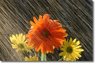
Weather Topic: What is Precipitation?
Home - Education - Precipitation - Precipitation
 Next Topic: Rain
Precipitation can refer to many different forms of water that
may fall from clouds. Precipitation occurs after a cloud has become saturated to
the point where its water particles are more dense than the air below the cloud.
In most cases, precipitation will reach the ground, but it is not uncommon for
precipitation to evaporate before it reaches the earth's surface.
When precipitation evaporates before it contacts the ground it is called Virga.
Graupel, hail, sleet, rain, drizzle, and snow are forms of precipitation, but fog
and mist are not considered precipitation because the water vapor which
constitutes them isn't dense enough to fall to the ground.
Next Topic: Rain
Current conditions powered by WeatherAPI.com


